Ohoi
Information for a safe and pleasant boat trip
NAIS
Show ship locations in Norwegian waters.
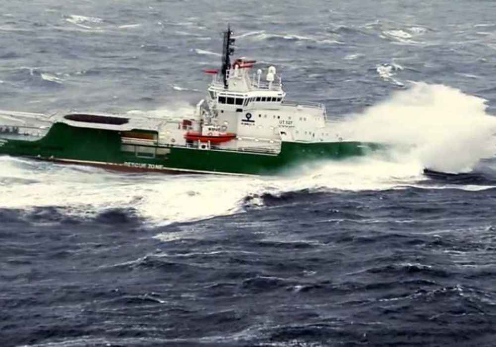
ArcticInfo
Service for vessels in Arctic waters.
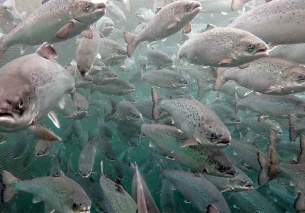
AkvaInfo
Aquaculture in your municipality
FishInfo
See fishing relevant map information from Norwegian authorities and download files for use in chartplotter.
Wave Forecast
Wave forecast for particularly vulnerable areas and stretches along the Norwegian coast.
Marine Spatial Management Tool 2.0
A tool for updating the management plans for the maritime zone and dissemination of these.
Fishhealth
Weekly overview including salmon lice, diseases and countermeasures down at locality level.
Fishery activity
Historical overview of fishing facilities.
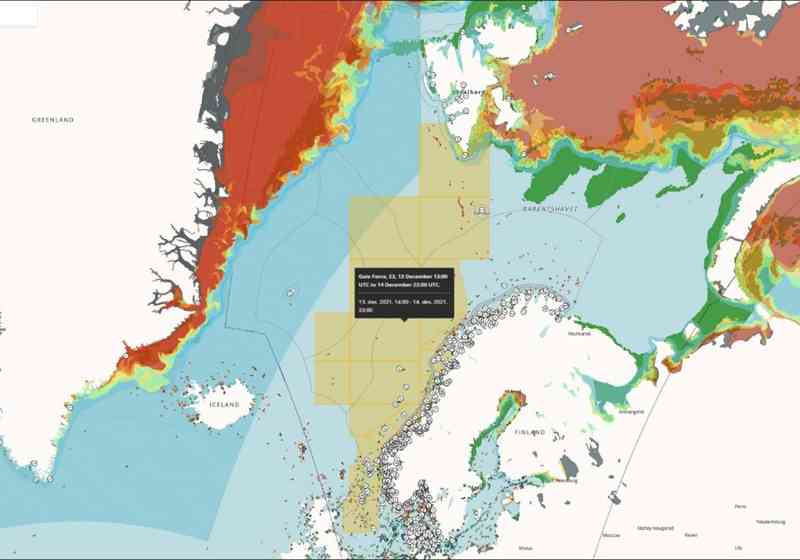
Polar Lows
Receive polar low forecasts and warnings by sms or e-mail.
Saltstraumen
Automatically updated forecast for the Saltstraumen tidal current the coming 48 hours.
Would you like to use the data we share to develop new digital services?
Most of the data you find in our services is also available as open data through API's or downloading.
Articles
Safer seaborne voyages in the Arctic
ArcticInfo provides important information on sailing conditions in the Arctic, supporting decisions for safer navigation in Arctic waters.
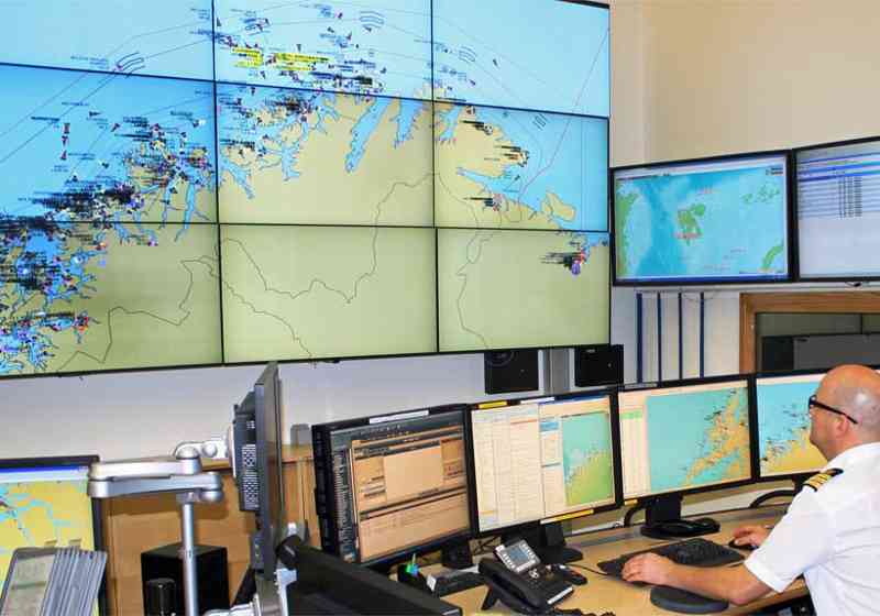
Analysing across agencies
Technical solutions from BarentsWatch are set to help an analysis unit at the Vardø vessel traffic service (VTS) centre in northern Norway with exposing illegal activity on the high seas.
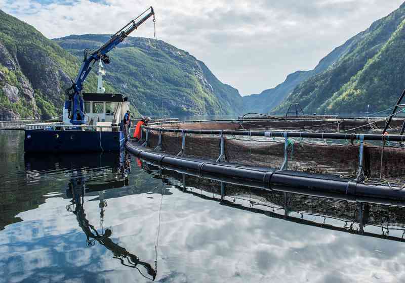
The Fishhealth service updated
A better overview of the areas and locations that are of interest to you. In addition, users can see all types of ships visiting facilities.
What Is the Arctic?
The Arctic is the area around the North Pole. But there is no simple definition of exactly what area the Arctic encompasses – rather, there are several such definitions.