Sound waves are transmitted into the ground, and the way they move down into the ground are recorded by the measuring apparatus on board seismic vessels. Because the waves travel at different speeds depending on the rock they pass through, these measurements provide a picture of the rocks' distribution, thickness and hardness. This provides an indication of whether there may be oil or gas in the area.
From dynamite to 4D
Data acquisition is often referred to as "seismic shooting". The first seismic surveys on the Norwegian continental shelf took place in the early 1960s. At that time both dynamite and nitroglycerine were used to create loud explosions where the sound was subsequently recorded by underwater microphones or hydrophones. Dynamite was soon replaced by airguns, which is now the most common way to create sound waves.
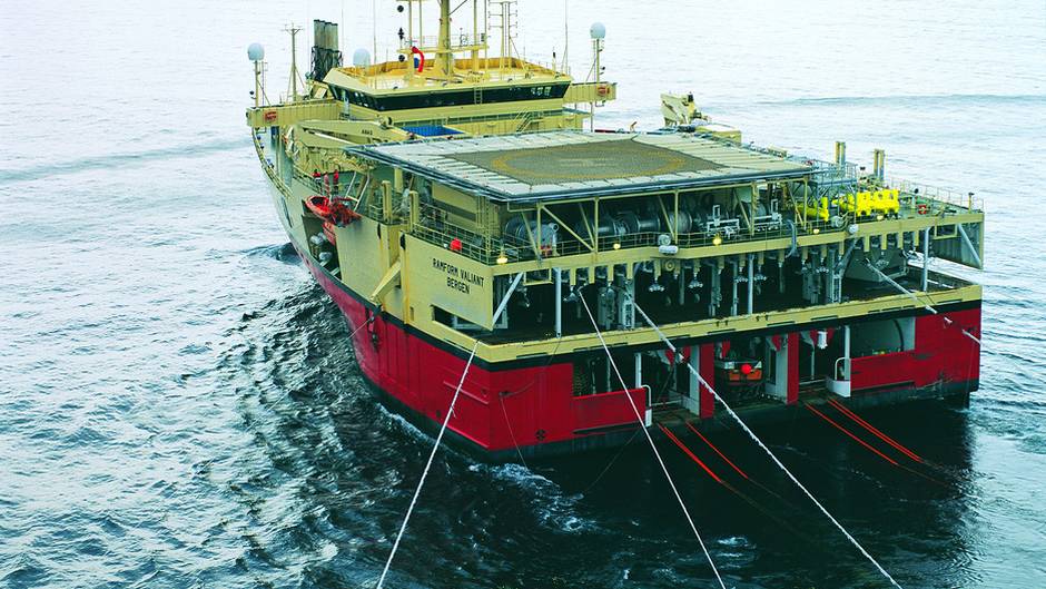
When a data acquisition expedition is in progress, long streamer cables are towed by a survey vessel. These cables are usually seven or eight metres below the surface. In the 1970s, large parts of the seabed off Norway was surveyed using two-dimensional (2D) seismic, undertaken with one long streamer cable.
During the 1980s, three-dimensional (3D) seismic was adopted. In such acquisitions, several parallel cables are towed behind the vessel. This makes it possible to cover larger areas, and provides a three-dimensional image with large amounts of information about the subsurface. Today most of the shelf that is opened for oil and gas operations is mapped using 3D seismic.
Seabed seismic is a type of acquisition where sensors are placed on the seabed instead of being towed by a ship. 3D seismic has been developed to 4D, which is a method for monitoring oil and gas reservoirs.
Using precise positioning and control of the cables, seismic surveys can be repeated, and new data can be added to the existing 3D data. Thus it is possible to record developments inside the reservoir over time.
Seismic is thus used both to find out whether oil and gas is hidden in the subsurface and to monitor reservoirs in fields that are in operation.
Permission required
Norwegian authorities have acquired seismic data since 1969 and made the information available to companies wishing to explore for oil and gas.
All seismic data acquisition associated with oil and gas activities on the shelf must be authorized by a production license or exploration license, and all seismic surveys must be reported to the Norwegian Petroleum Directorate.
Seismic data are grouped according to who collected it and what it is used for. Commercial seismic includes seismic owned by licensees in production licenses and marketable seismic. Companies that want to collect commercial seismic, must have permission from the Norwegian Petroleum Directorate.
Effects on fish
In order for data acquisition not to conflict with ongoing fishing, a fishery expert must be on board the seismic vessel.
The question of whether the sound from airguns scares away fish and fry has been much discussed. In 2009 the Ministry of Petroleum and Energy and the Norwegian Pollution Control Authority (Klif) presented a report that failed to arrive at any definite conclusion. The following year the Institute of Marine Research published the results of its research into fish that were caught in Vesterålen before, during and after seismic acquisition took place in the summer of 2009.
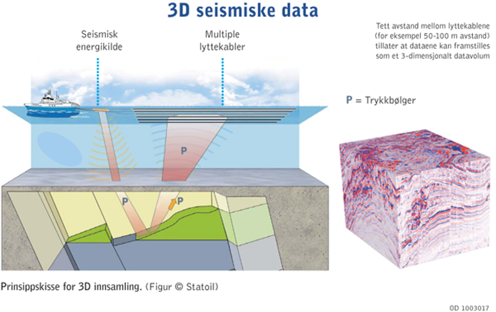
Illustration in Norwegian: Seismic acquisition where sound waves are transmitted into the subsurface. The way they move is captured by streamer cables behind the vessel.
(Institute of Marine Research).
By Astri Sivertsen.