The trajectory models use forcing from weather, current and waves models to calculate the most accurate trajectory of a given object . Operational forecasts plays a significant role both in planning and when a real accident occurs and swift decisions have to be made. Knowledge of the direction in which an oil spill is moving during the first days is vital for the best possible location for placing booms and spreading dispersants in order to protect the shoreline.
Full City
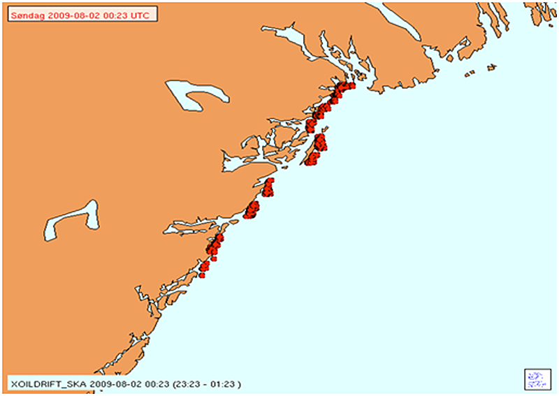
When the cargo ship "Full City" ran aground south of Langesund on July 31 2009, the Meteorological Institute was quickly contacted. The ship leaked large amounts of heavy oil, and over the next few days the coastline between Grimstad and Larviksfjord were soiled. Information about how the oil spill would move and spread was important for planning and mobilization.
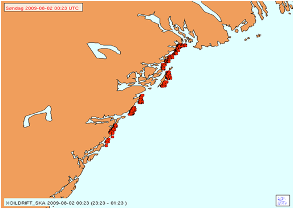
The figure shows the results of an oil-drift model simulation for the Full City accident, for August 2 2009.
Different objects
Containers falling off ships and floating around in the sea are a hazard to both shipping traffic and offshore installations. People who have fallen overboard from a boat have to be found as quickly as possible. Trajectories of a wide variety of objects can be calculated by a specially developed trajectory model to assist search and rescue by identifying the most probable search area. The Norwegian Meteorological Institute has also developed a model to calculate the most probable trajectories for ships that have lost engine power. Drifting ships may damage permanent installations such as platforms or even oil and gas pipe lines if an anchor is trailing deep down below the ship. The shipdrift model is similar to the search and rescue model, but also takes into account the forces acting on the large hull itself, as well as the currents, waves, and wind that act on the water.
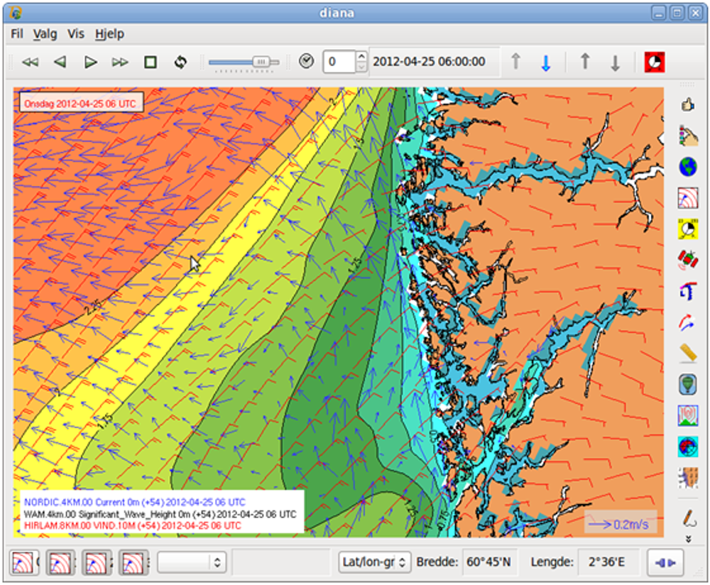
The figure shows an example of wind, current and wave information from numerical models.