The word “Arctic” is used in Norway in various contexts. For example, the three country governors in Northern Norway (Nordland, Troms, and Finnmark), the Sami Parliament, and Nordland County administer funds for developing Arctic agriculture. The University of Tromsø is called UiT Arctic University of Norway. The government’s policy for the High North focuses on the regions north of the Arctic Circle. Climatically, however, only parts of Eastern Finnmark fulfil the criteria for being part of the Arctic.
The most common definitions of “Arctic” are in the categories climatic/botanical, marine, and political.
Arctic landmass
The Arctic landmass is divided into three zones: the High Arctic, the Low Arctic, and the Subarctic. It is the climate and the vegetation that determines the division and demarcation of the three Arctic landmass zones.
The Subarctic (i.e., the area south of the Arctic) is a transitional zone between the tree line and the zone with contiguous boreal (i.e., Northern) forests.
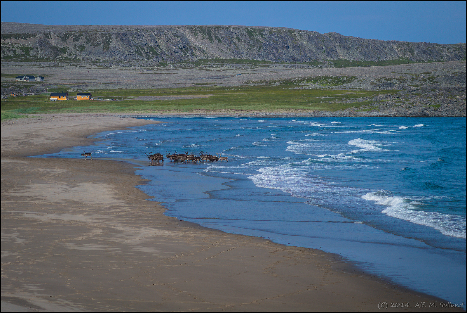
The tree line, which is the limit for where trees at least two to three metres tall can grow, serves as the boundary between the Subarctic and the Low Arctic. There are local variations, but the tree line usually coincides with the 10° C isotherm for average July temperatures, as trees have a hard time growing and seeding if the average temperature for the warmest month (July) falls below +10° C. The temperature record for 1960–1990 determines the current 10° C isotherm. According to this record, the average July temperature for the town of Vardø in Eastern Finnmark is +9.2° C, while the corresponding July temperature for Tromsø is +11.8° C. From a climatic definition, Vardø thus is part of the Arctic, while Tromsø is not.
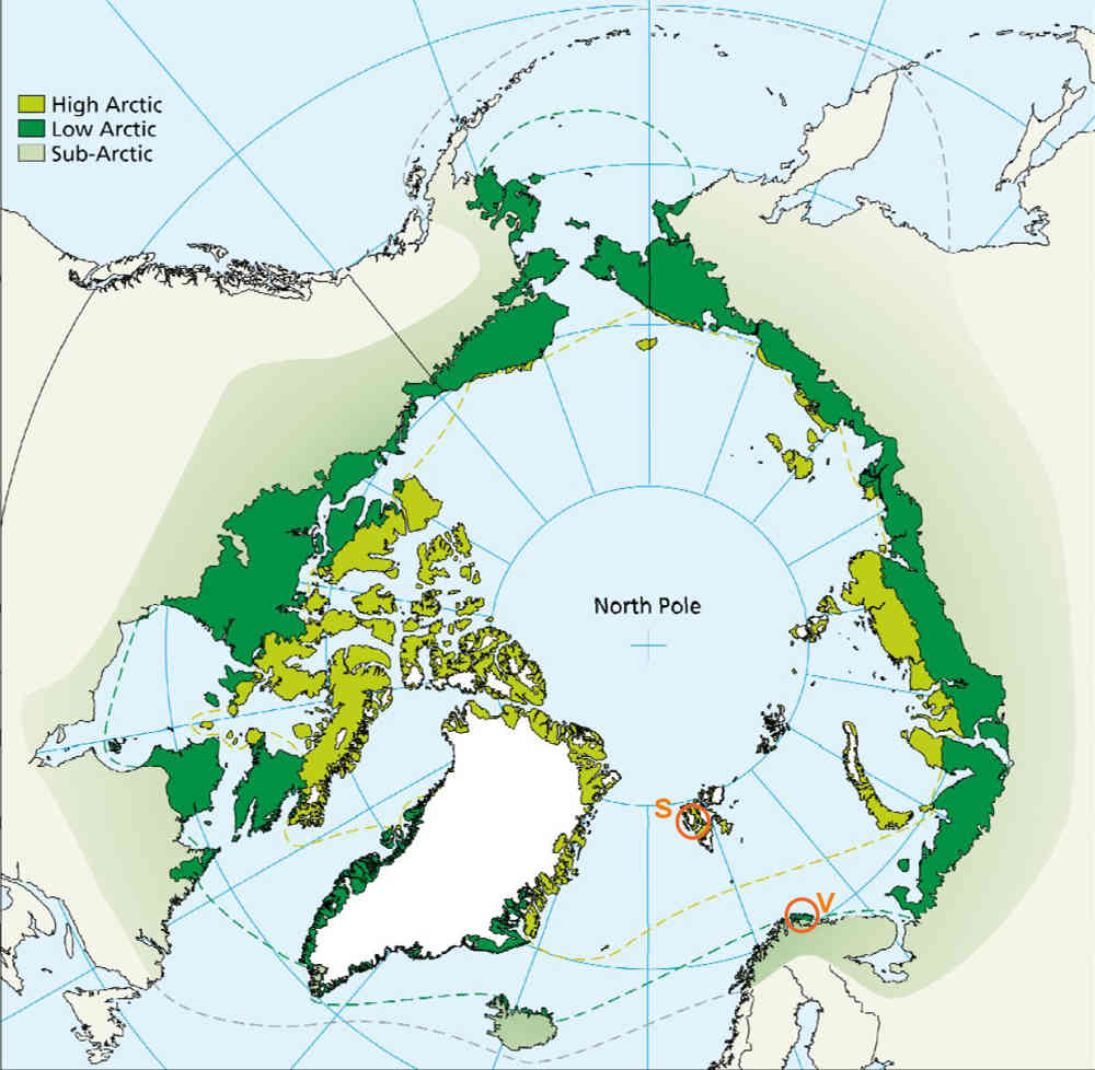
Illustration: COAT (UiT)/CAFF (Arctic Council).
There is no corresponding fixed temperature boundary between the High Arctic and the Low Arctic. This boundary is instead determined by the type of vegetation. In the Low Arctic, woodlike vegetation such as shrubs, willows, and heather can grow, but in the High Arctic the climate becomes too harsh even for such vegetation. In the High Arctic, only flower plants, grass, grass-like plants (sedges), moss, and lichen can grow, and the vegetation cover is often non-contiguous.
The various species’ ability to withstand cold varies more for shrubs, willows, and heather than for trees. As a result, the boundary between the High Arctic and the Low Arctic does not follow the temperature to the same degree as the boundary between the Low Arctic and the Subarctic. Other factors, such as grazing pressure from animals, varying degree of moisture, and soil conditions, also result in local variations. Climatic changes, such as rising temperatures, are shrinking the area that is climatically defined as the Arctic, as the tree line creeps ever more northwards.
“It is the Arctic Council, with its secretariat in Tromsø, that has determined the boundaries for the Arctic on land,” says Rolf Anker Ims, professor of Arctic and marine biology at UiT Arctic University of Norway.
The maritime Arctic
The marine boundaries for the Arctic are literally fluid. According to Paul Wassmann, professor of Arctic and marine biology at UiT Arctic University of Norway, the marine Arctic can be divided into three main groups: permanent ice, the seasonal ice zone (where the ice has been), and the marginal ice zone (drift ice, including the ice edge).
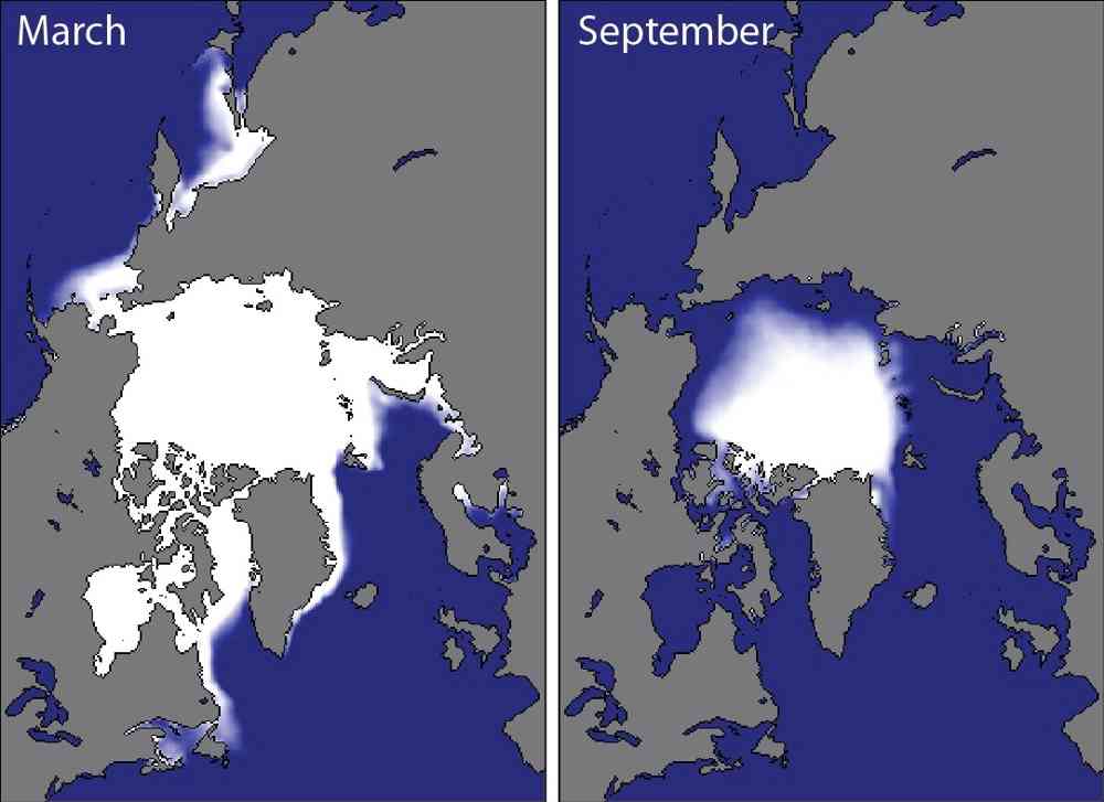
The size of the maritime Arctic can be illustrated by the maximum extension of the ice. Ill.: UiT Arctic University of Norway.
Permanent ice is found in the areas in the Arctic Ocean that do not melt away during the summer, in other words the area that is still covered by ice when the ice cover reaches its minimum level in September.
The seasonal ice zone is the open expanse of sea that was covered by ice during the ice’s maximum extension in May but that has melted away during the summer. Such areas are oligotrophic, that is to say they offer little to sustain life. The meltwater from the ice stratifies the surface water and thus hinders circulation, so that only limited amounts of nutrients from the ocean floor reach the surface.
The ice edge is where the ice cover meets the open sea. The productivity here is often high when nutrient-rich water is exposed to sunlight after the ice melts or breaks up.
Put simply, this means that the marine Arctic is the area that was covered by ice during the ice cover’s maximum extension in May. This area varies from year to year.
“More of the Subarctic marine areas should be included in the definition of the Arctic because the ocean currents leading into the Arctic Ocean are very important for life there. For animal plankton north of Svalbard, the Arctic already ‘begins’ outside of the Lofoten Islands [in Northern Norway],” says Wassmann.
90 per cent of the water currents into the Arctic Ocean flow through the Barents Sea and the areas around Svalbard. A corresponding amount of cold Arctic water flows out through the left-hand side of the Fram Strait between Greenland and Svalbard. Only 10 per cent of the water flowing into the Arctic Ocean goes through the Bering Strait between Russia and Alaska.
The political Arctic
“Given the role of states in international politics, it is natural to begin with the Arctic countries when defining the Arctic politically,” states Gunnhild Eriksen at the Section for the High North, Polar Affairs, and Marine Resources at the Norwegian Ministry of Foreign Affairs.
The Arctic Council is the premier forum for international cooperation on Arctic issues. The council consists of the eight states with land areas north of the Arctic Circle: Norway, Sweden, Denmark (with the Faroe Islands and Greenland), Iceland, Finland, Russia, the United States, and Canada. The Arctic Council is the only intergovernmental forum where the Arctic states convene to cooperate on the challenges they face. The Arctic Council was formally established in 1996 in Ottawa to promote sustainable development within the environment, social conditions, and the economy.
In addition to the eight member states, six international organizations representing indigenous communities have been recognized as permanent participants in the council, while several non-Arctic countries, international organizations, and NGOs have an observer status.
Another potential political definition of the Arctic is based on the Arctic Ocean. The so-called Arctic Five consists of the coastal states around the Arctic Ocean: Norway, Denmark (in respect of Greenland), Russia, the United States, and Canada. These states have economic zones and continental shelves towards the Arctic Ocean in line with the law of the sea. The Arctic Five is not institutionalized, but the cooperation has been confirmed through the Ilulissat Declaration of 2008.
“A recent example is from July 2015,” Eriksen says. “That’s when Norway and the four other coastal states around the Arctic Ocean signed a declaration on research and measures against unregulated fishing in the international part of the Arctic Ocean. The declaration is a collective expression that the coastal states take responsibility pursuant to the law of the sea also for the fish populations of the Arctic Ocean.”