ArcticInfo is a free of charge service that provides important information on Arctic waters and decision support for safer navigation.
The service provides information specifically for vessels that operate in Arctic waters, such as fishing vessels, cruise traffic and research and expedition vessels.
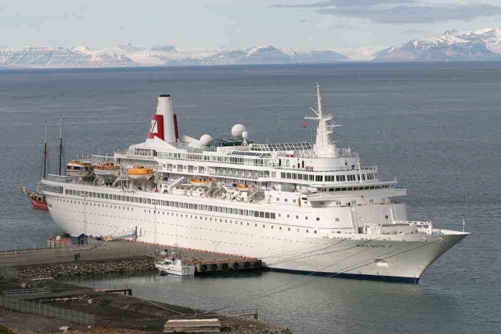
Increased cruise traffic is a good reason to improve information about the sea areas in the north. Photo: The Norwegian Coastal Administration.
By using the service, vessels gain access to relevant information about Arctic areas, and sea areas off the coast of Norway, the Russian Federation, Canada and Greenland, including the Barents Sea and the North Sea. The service includes ice maps, including ice concentrations and drift ice, weather forecasts, notification service to Greenland authorities, and AIS data that gives an overview of other vessels in nearby areas, making it a useful tool in emergency-situations.
Apply for extended access
ArcticInfo is a free of charge service accessible to everyone at BarentsWatch, https://www.barentswatch.no/arcticinfo. With extended access, you can get AIS information for the entire Arctic area. By linking your vessel to your individual user account, you can easily locate your vessel in the map. If you are sailing in Greenland waters, you can also send voyage plans to Greenland authorities through the ArcticInfo service. You can submit an application for extended access online, which is processed manually in normally 1 or 2 days.
See application form here. (Remember to register as a BarentsWatch user first.)
Improved planning, safety and emergency preparedness
Low temperatures and extreme weather conditions, periodically low daylight, limited communication facilities and infrastructure, poor charts and vast distances with limited resources are some of the challenges for shipping in Arctic waters.
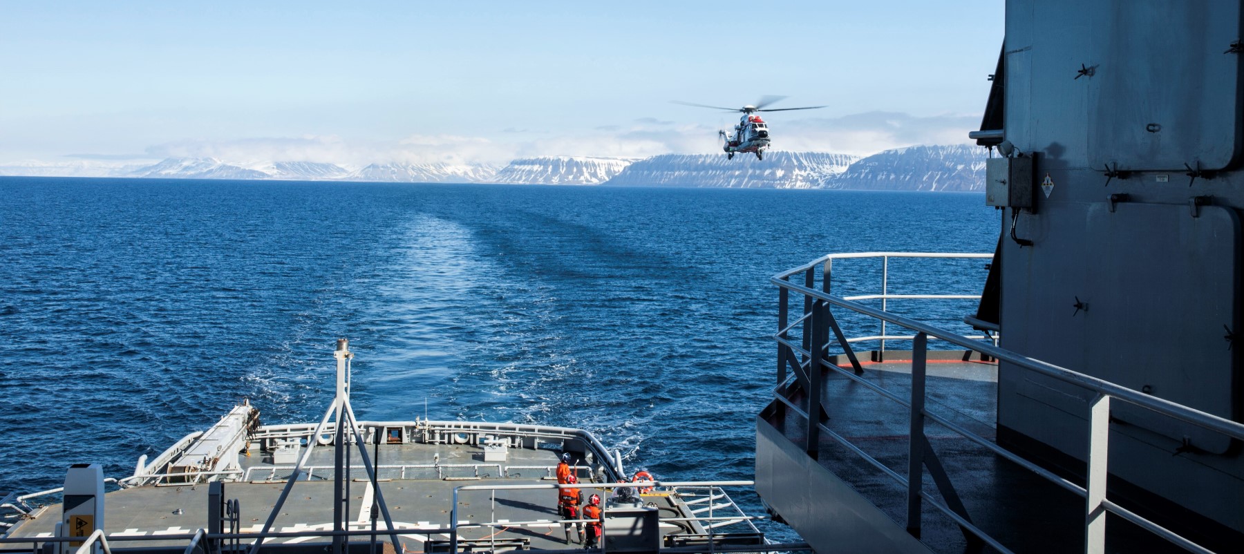
With ArcticInfo you get a better overview of different types of activity. Photo: The Norwegian Coastal Administration.
“Increasing ship traffic in a region with many limitations and challenges places greater demands on planning, safety and emergency preparedness. Our aim is to provide important shipping-related information digitally in one service, giving mariners a better overview of Arctic waters, and thereby providing decision-making support for safer navigation,” says Head of the NCA Centre for Pilotage and Vessel Traffic Services, Jon Leon Ervik.
Vessels with limited communication capabilities can also download the service and use it offline. The web service is stored in your browser, so when you are offline the map will continue to work where you have previously clicked while you were online.
The NCA wants to reduce the risk of incidents and accidents that can have consequences for people and the environment in Arctic areas. This service aims to provide user-friendly digital information for maritime operators both on and offshore.
The service will be further developed
“The service will be further developed to include more information services and data on Arctic waters,” says Ervik. “We want to develop a functionality that allows mariners to enter observations on weather, ice conditions, pollution and wildlife that can be shared with other users of the service.”
The Norwegian Coastal Administration uses BarentsWatch to develop the service. The service gathers, develops and shares information about Norwegian coastal and marine areas. The goal is to facilitate information sharing between governmental agencies, industry and the public.
«By smoothly developing digital services, BarentsWatch addresses the needs of our users. User needs form the basis of the systems and solutions we have developed and will continue to develop together with different partners. This is also the key philosophy behind ArcticInfo,” says CEO Geir Schulstad in BarentsWatch.
Replaces Danish digital information service
ArcticInfo replaces ArcticWeb, a Danish digital information service for shipping traffic in waters off the coast of Greenland, which was taken over by the Norwegian Coastal Administration in 2013. Since then, the service has been further developed and extended to include the Barents Sea and North Sea.
To ensure that ArcticInfo meets user needs, the Norwegian Coastal Administration requests users to provide feedback (criticism, praise, questions and ideas). Feel free to use the "Give Feedback" feature on the ArcticInfo website.
Contact details:
Head of the NCA Centre for Pilotage and Vessel Traffic Services, Jon Leon Ervik
Tel: +47 916 81 538, jon.leon.ervik@kystverket.no
Project Manager Eivind Rinde, BarentsWatch
Tel: +47 906 96 094, eivind.rinde@barentswatch.no
Facts on ArcticInfo, version 1.0:
- The service is map-based, free of charge and accessible to everyone.
- You must register online to gain access to the service.
- In the online menus, you can select different map layers:
- Ice edge and ice concentration (drift ice and solid ice)
- Weather data on wind direction and strength, currents and temperature
- Depth curves with an overview of seabed topography
- Information on quay conditions
- Overview of Norwegian sea borders
- An option to send voyage plans digitally to Greenland authorities
- An overview of ice edge and ice concentration is updated by the Norwegian Meteorological Institute every business day - Monday to Friday. Weather forecasts are updated continuously.
- Real-time AIS data shows all vessels in Arctic waters (position, speed and course) - based on governmental AIS data from different countries.
- Includes ship-specific information from ship registers NIS / NOR.
- Enables users to edit data on their own vessels - maximum speed, ice class, gross tonnage, rescue capacity, communication possibilities, and whether the vessel has helicopter decks and doctor / nurse on board.
- Displays Danish navigation warnings or reports on irregularities in the area.
- Available in Norwegian and English.
- Available in day and night mode.