The Norwegian Mapping Authority
The Norwegian Mapping Authority has national responsibility for geographic information, and manages and coordinates work on the national geographical infrastructure in Norway. Responsibilities include organizing data and information flows between government agencies for land, marine and coastal areas in Norway and around Svalbard, and the waters around the poles.
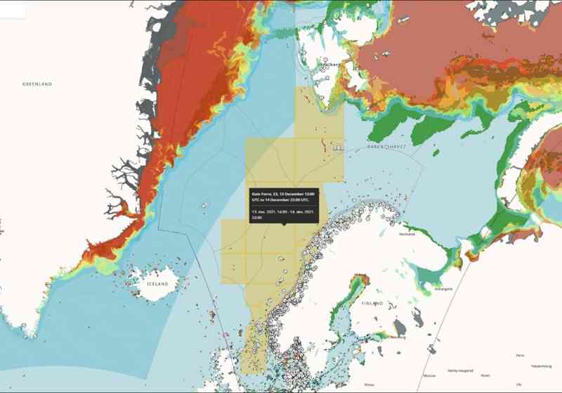
The Norwegian Mapping Authority is the only authorized publisher of official nautical charts and borders in Norway. In addition to its cartographic work, the Norwegian Mapping Authority is also responsible for information on tides, currents and GPS corrections. The Norwegian Mapping Authority has operational responsibility for the international hydrographic service Primar and supplies official electronic nautical charts to international shipping on behalf of some 40 nations.
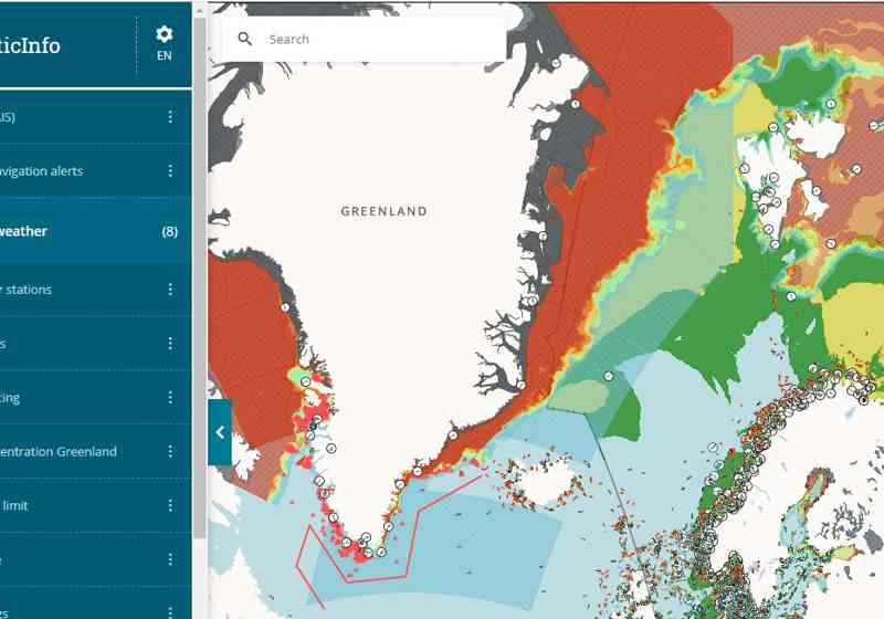
The Norwegian Mapping Authority is represented on the board and resource group for BarentsWatch. The Norwegian Mapping Authority provides base maps for land areas, depth maps, boundary data, etc. to BarentsWatch's map client and participates in collaborative technology and content projects.